Salmon River Gorge
April 1983 Expedition
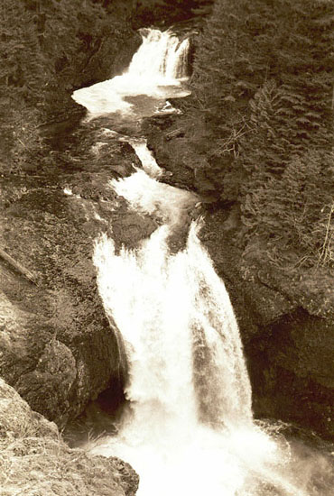
Final Falls
|
This is the view from the exposed
cliffs below the first high bluffs on the Salmon River Trail.
The slope here is an unstable scree with little vegetation, and
is particularly slippery. From this viewpoint, both Final Falls
and Upper Final Falls can be seen. Comparisons with similar
images from the 1963 Naming Expedition show that in the low
water of late summer, the upper falls is reduced to less than
one half that seen in this photo, while Final Falls continues
to flow in a wide plume.
The 1963 Naming Expedition somehow
managed to reach river level in this area, walking to the brink
of the cliffs in the lower left of this image to photograph Final
Falls. From this vantage point, it is unclear how the 1963 expedition
reached the river without the aid or ropes and a dangerous rappel
over unstable cliffs.
|
 These photos are ©Tom Kloster 1983,
and may not be reproduced or used without permission
Next Image from the April 1983 Expedition >
< Back to Index Page
These photos are ©Tom Kloster 1983,
and may not be reproduced or used without permission
Next Image from the April 1983 Expedition >
< Back to Index Page